Susan Peake Grave
Narrative
Henry Peake inherited the property and mill from his father, John Peake in 1799 following his death. Susan was Henry's first wife and died in 1808 or 1809. He put an ad in the Alexandria Gazette listing the property for sale in 1829.
Alexandria Gazette 1 Oct 1829
PUBLIC SALE OF VALUABLE LAND will be exposed to public sale, on the premises, on the 12th day of December next, if not previously disposed of, the TRACT OF LAND on which the subscriber formerly lived, in the county of Prince William, containing between SIX AND SEVEN HUNDRED ACRES, situated only 22 miles from Alexandria, 12 from Dumfries, and 8 from the Occoquan Mills, where produce may be disposed of at the Alexandria prices. Two thirds of this land is very heavily timbered, consisting of white oak of the largest size, black oak, hickory, beech, &c &c. there are one hundred acres of low ground, the third of which is in timber, the remainder was formerly, and still made be made a valuable meadow; there is also a GRIST MILL, now out of repair, the only one in the neighborhood, and an excellent situation for a Distillery, there being none within 18 miles of the place. The springs are very numerous, so much so as to form the run which turns the mill, and furnishes an abundance of water, except in the dry season. For a grazing farm, there is none in Virginia superior, as it is remarkably adapted to clover and plaster (the latter of which may be had only eight miles distance at the Alexandria price) no forty acres being without a never failing spring. Persons wishing to purchase will do well to attend on that day, as the terms will be of the most accommodating kind, no payment being required for several years after the sale. The land will be shown to persons wishing to examine by Mr. Milstead, living on the premises. Any communications made on the subject must be directed to the subscriber, near Newtown, Frederick County Virginia.
Henry Peake 25 Sep 1829
D.W. Delaney bought the property in 1890 and it is still owned by a decendant as of 2022.
The property is in the book, Prince William, it's people and places and says:
On County 642 is the SITE OF PEAKESVILLE, where rotting logs indicate the location of several outbuildings but where no vestige of the original house is to be found. Though the outline of the family burying ground is still visible, no inscriptions mark the resting places of Peakes who once lived here. A few miles northward on the banks of the Occoquan is the site of a grist mill, known as Priest's Mill, which continued to operate well into the twentieth century. The antiquity of the mill is evidenced by a bill of sale from William Champe to John Peake dated 1735 and mentioning the mill. In an indenture the tract is described as belonging to John Peake and his wife Mary, who purchased it in 1721 from Wansford Arrington, who is known to have received in 1716 several grants from the proprietors of the Northern Neck.
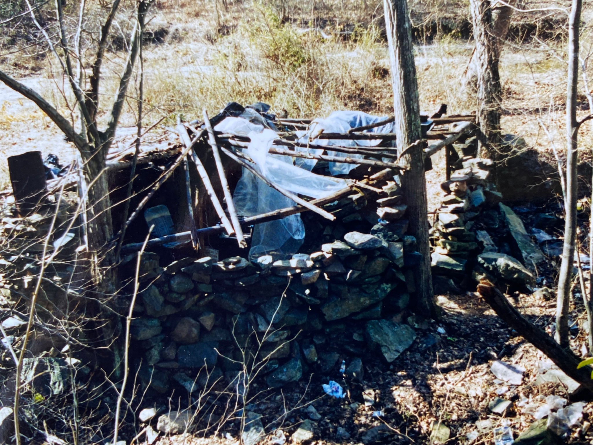
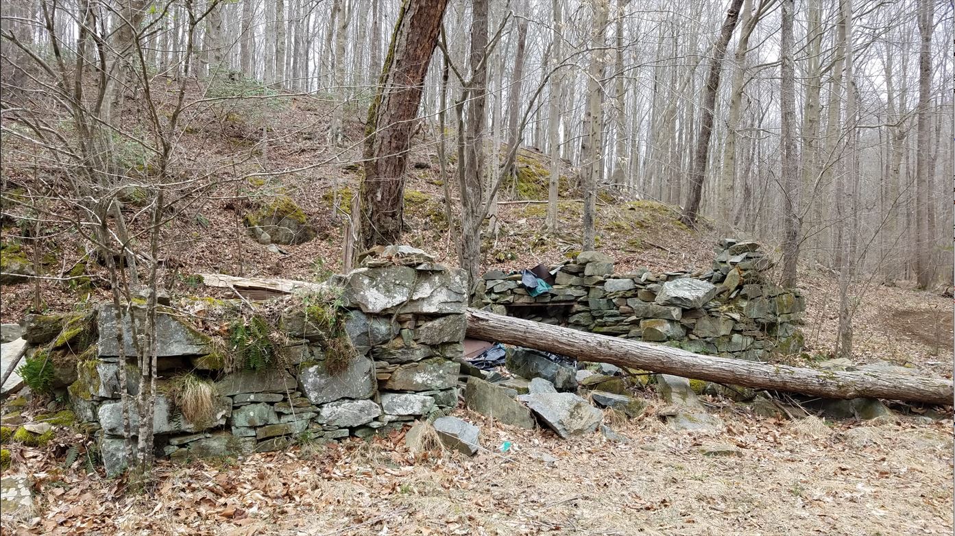
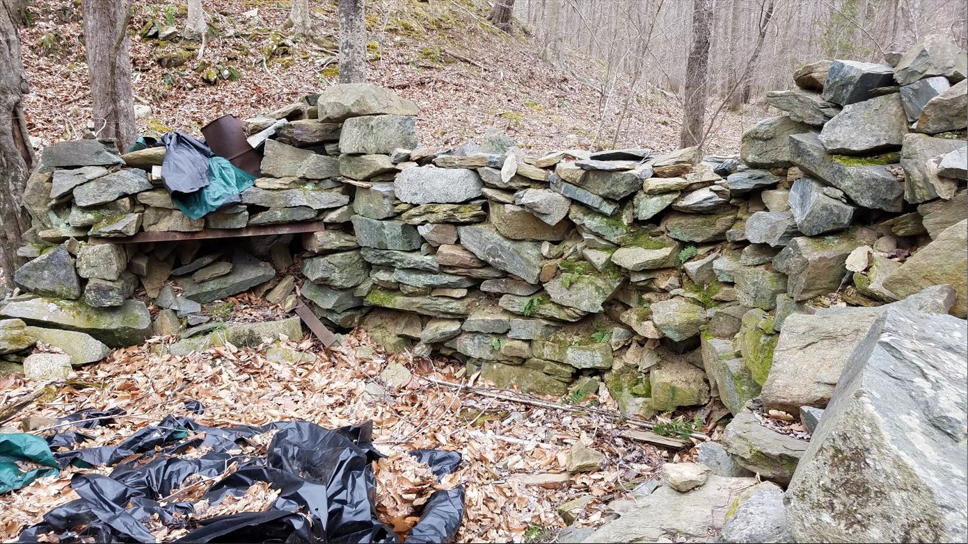
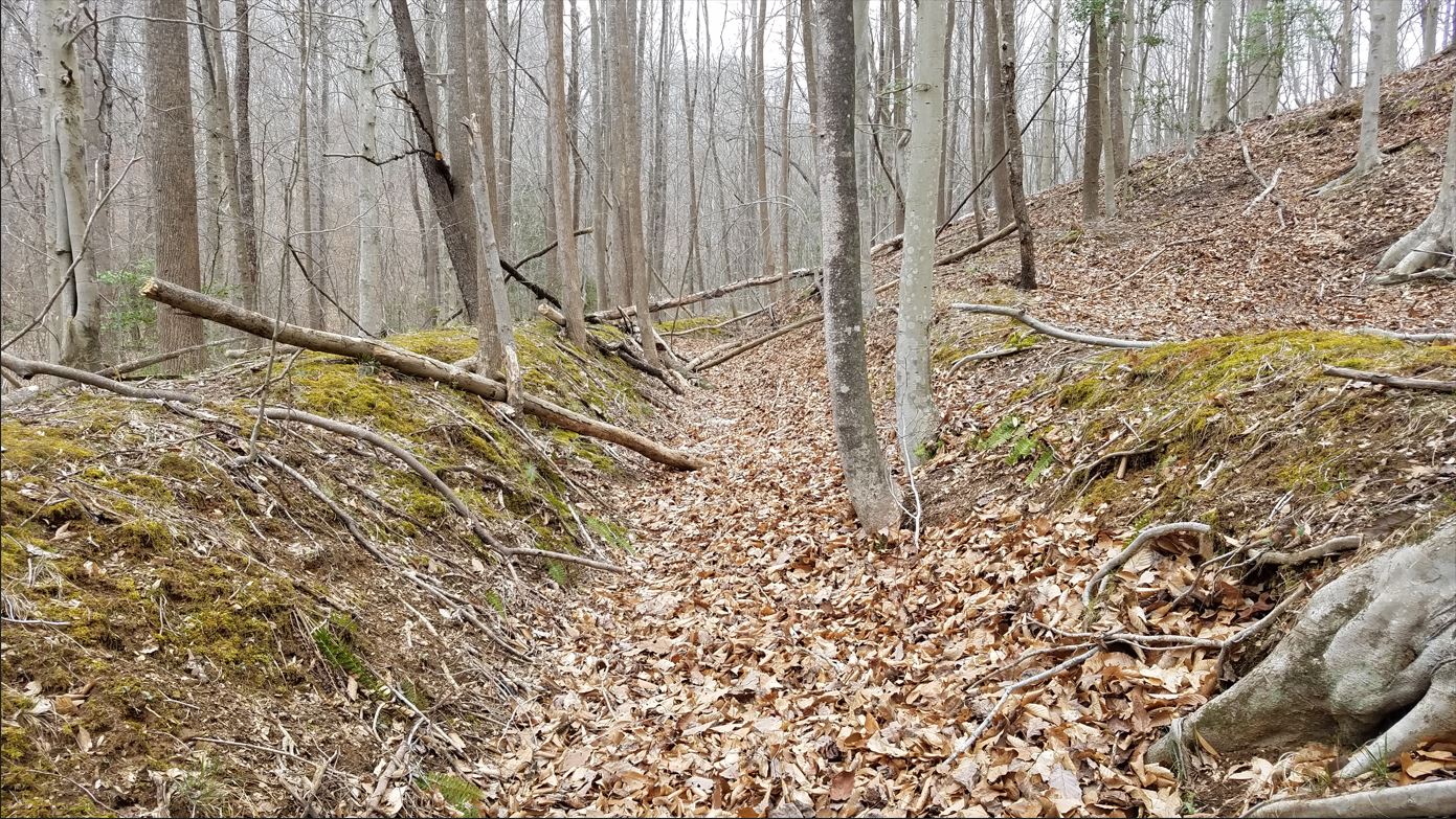
Pictures of the Mill area
Images taken in 2001
Images taken in March 2020
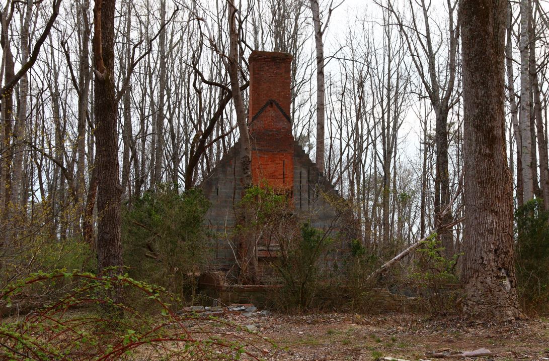
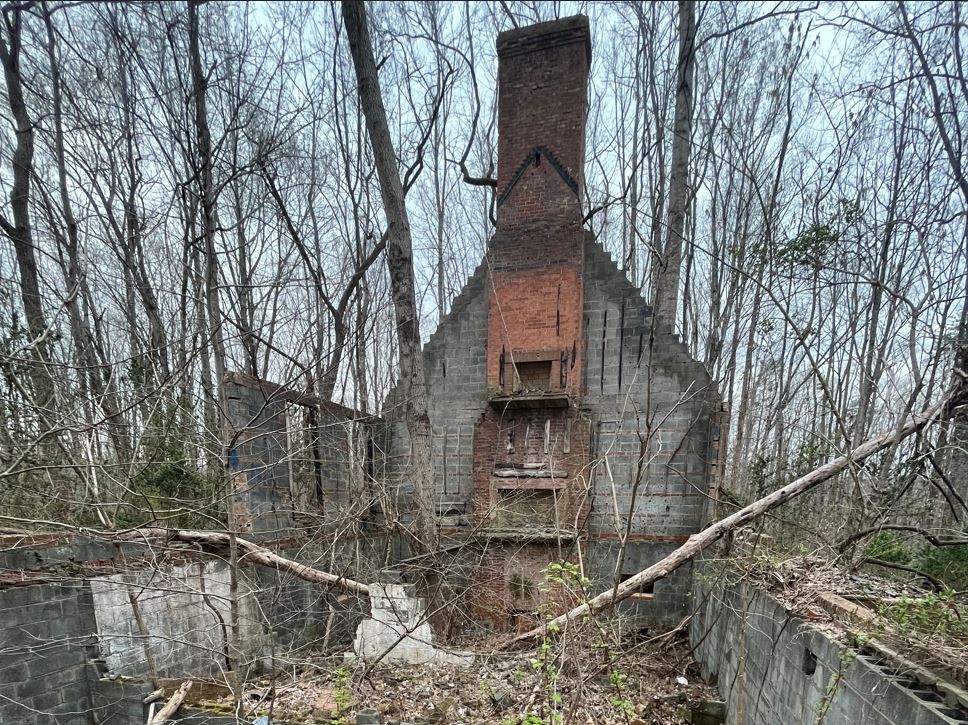
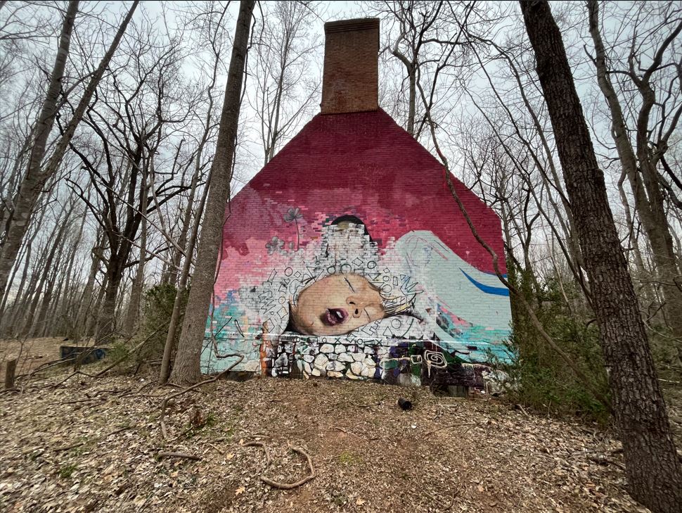
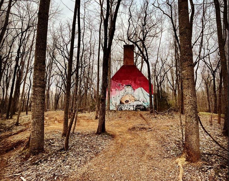
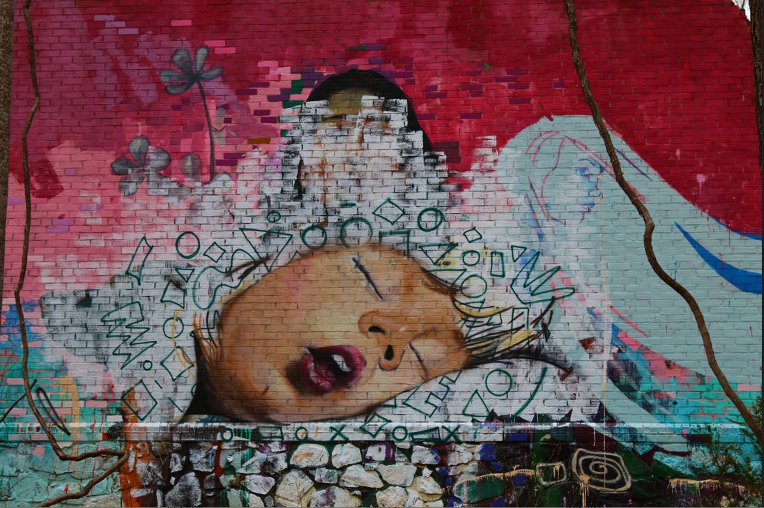
Modern House Ruins
Images taken April 2022
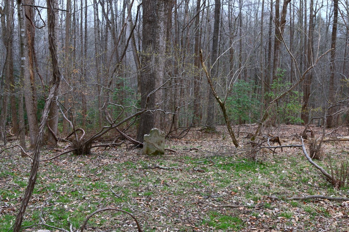
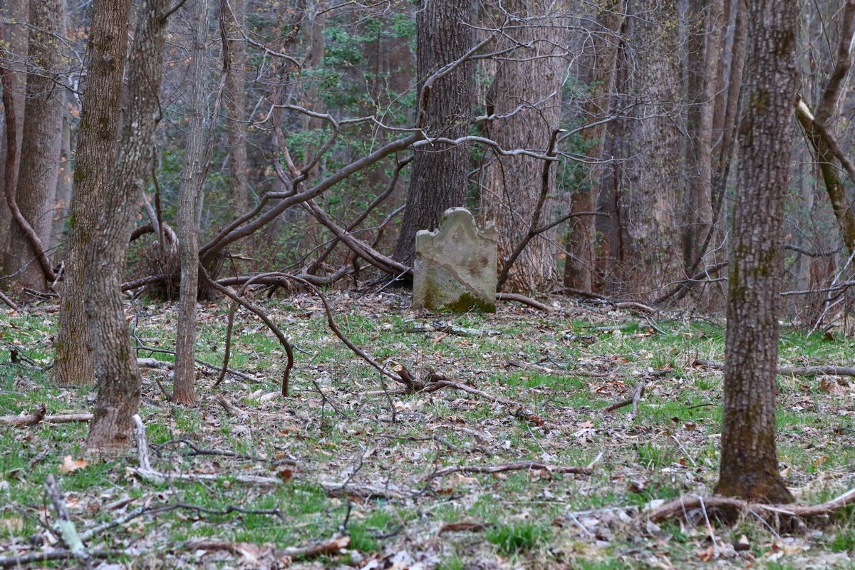
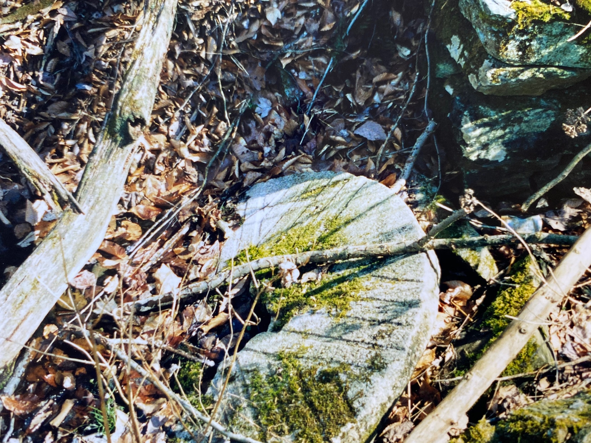
Grave Marker
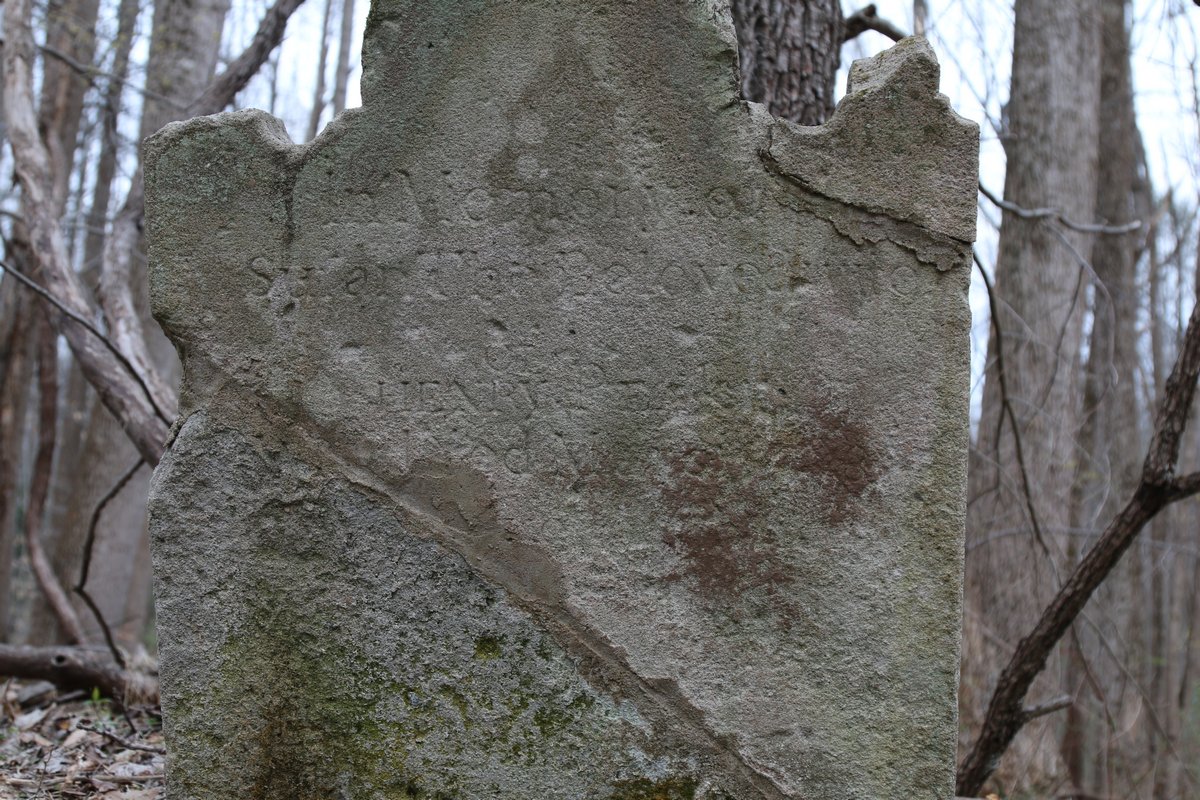
The headstone was broken at some point and repaired but the ground around it was disturbed decades ago. No depressions are visible and no other stones were seen. Perhaps the stone was broken several decades ago and was uncovered when they were moving dirt around to build the brick house in the (guessing) 1960s. The write up above would lead you to believe there were more burials. Henry Peake had six children between two wives. One of his children died the same year as Susan. The mill was likely known as Priest's Mill and the area around it, where people lived was known as Peakesville, maybe just by the family and close locals. Recently the mill has been refered to as Peake's Mill.
Survey Details
| Classification: | Family |
| Status: | Not Maintained |
| Condition: | Poor |
| Approx. Size: | 5 x 10 feet |
| Approximate Number of Burials: | 1 |
| Markers: | 1 Tombstone |
| Surnames Listed on Markers: |
Susan Peake |
| Comments: | Marker says "In Memory of Susan, the beloved wife of Henry Peake, died M"...not legible but likely in 1808 or 1809. |
| Surveyed By: | David Cuff - April 2022 |
| Latitude / Longitude: | 38.698055, -77.382777 |
Site Visits
| Visited by: | Date: | Comments: |
|---|---|---|
| David Cuff | April 2022 | Marker is approx. 115 feet east of brick structure in an area that was disturbed several decades ago. |
Images
Images taken April 2022